|

|
Please
note:
The
trip and waypoint management functions of this product work with
nearly all GARMIN GPS units, excluding the GPS100 family and panel
mount aviation units. The map download feature of this product
is recommended for use with the GPS III Plus, NavTalk, GPS 12MAP,
and GPSMAP 162/168. It is compatible with StreetPilot GPS, StreetPilot
ColorMap, GPSMAP 295, and eMap, which require a blank 8 or 16MB
cartridge to upload map data to these compatible units.
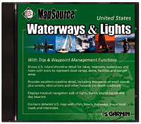
The MapSource™
United States Waterways & Lights CD-ROM includes trip and
waypoint management functions that allow you to transfer waypoints,
routes, and tracks between your PC and nearly all GARMIN GPS units.
US Waterways & Lights displays U.S. nautical navigation aids
of lights, buoys, sound signals and daybeacons; contains US inland
shoreline detail for lakes, reservoirs, waterways and rivers with
icons indicating boat ramps, dams, facilities, and danger areas;
and excellent coastline detail, including thousands of small islands
plus wrecks, obstructions and other hazards (no depth contours).
Detailed US map with cities, towns, highways, major local roads
and interstates. With a map download-compatible GARMIN GPS, simply
transfer maps from the PC to your compatible GPS unit. GARMIN
list price: $81.65
|