|
Coverage
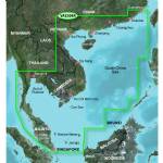
General coverage of the coasts of the Malay Peninsula, Thailand, Cambodia, Vietnam, and China east to Quanzhou, including Hainan Island and Macau. Included in this overall general coverage are numerous detailed charts covering areas such as Phuket, Thai., George Town, Mal., Singapore, Ho Chi Minh City, Viet., Guangzhou, Chin., Hong Kong, and Xiamen, Chin.
About BlueChart g2 Vision Maps
Chart depictions are enhanced with high-resolution satellite imagery for enhanced situational awareness so you can navigate with a clear moving-map representation of your boat’s position. It is the most realistic mapping display Garmin has ever offered in a chartplotter. With BlueChart g2 Vision data, you can select true 3D Mariner’s Eye or Fish Eye navigation perspective for dynamic views both above and below the waterline. There’s also Auto Guidance technology to suggest the best routes to follow. And aerial photos of ports, harbors, marinas, waterways and coastal roads help you see "the big picture" when you’re on the water.
- Realistic navigation features showing everything from shaded depth contours and coastlines to spot soundings, navaids, port plans, wrecks, obstructions, intertidal zones, restricted areas, IALA symbols and more
- Fishing charts to focus on bathymetric contours with less clutter on the display
- Choice of 3D Mariner’s Eye or Fish Eye navigation perspective to make chart reading and orientation easier
|
畫面顯示
 
Enhance Your Vision
High-resolution satellite imagery enhances chart depictions for superior situational awareness so you can navigate with a clear moving-map representation of your boat is position. It is the most realistic mapping display Garmin has ever offered in a chartplotter.
1 |
2 |
1High resolution imagery with navigational charts overlaid gives the mariner a realistic view of his or her surroundings.
2Crystal clear aerial photography shows exceptional detail of many ports, harbors, and marinas.
|
3 |
4 |
3Mariners eye view provides a 3-dimensional representation of the surrounding area both above and below the waterline.
4Fish eye view provides a 3-dimensional representation of the ocean floor as seen from below the waterline
|
Get the Best View
BlueChart g2 Vision data lets you select true 3-D MarinerEye view or FishEye view perspective for dynamic views both above and below the waterline. Auto Guidance technology suggests the best routes to follow.
Aerial photos of ports, harbors, marinas, waterways and coastal roads help you see "the big picture" when you’re on the water.
|